Cities, Towns, and CDPs
Overview
From Mandy:
We’re trying to make visible the places in Oregon with municipal government infrastructure and how that varies across the state. How can we support cities doing community building in a county where there are so few municipalities to begin with? What does it mean for the type of resource they need in order to make noticeable change for the people who live outside of them but count on their services? Some counties, for example, have very few incorporated places at all. Others have a ton; these places are better positioned by default for investment (like federal grants). So overall this will be a visual representation of the data that can help our staff understand the geography in a new light.
Graphs
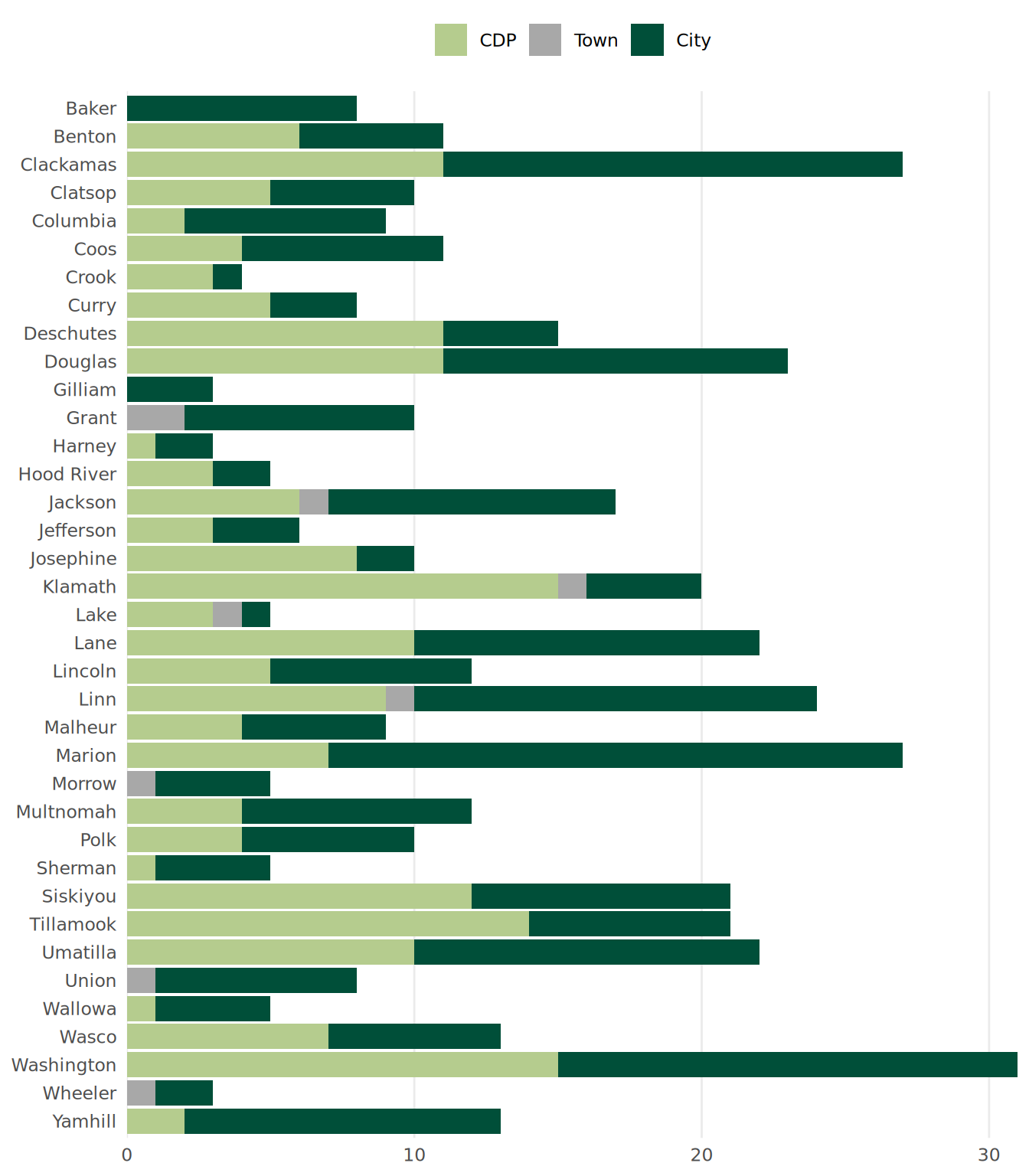
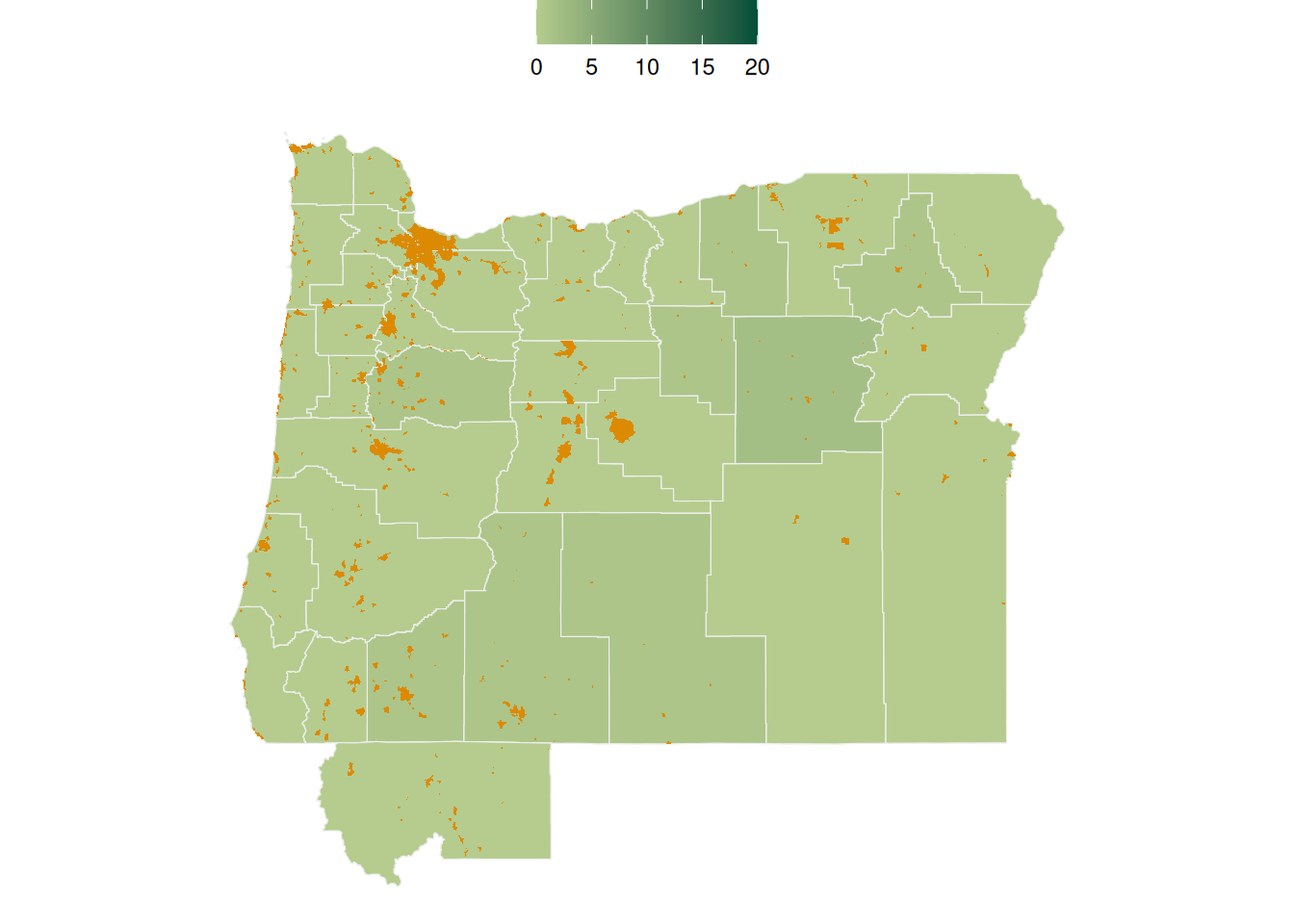
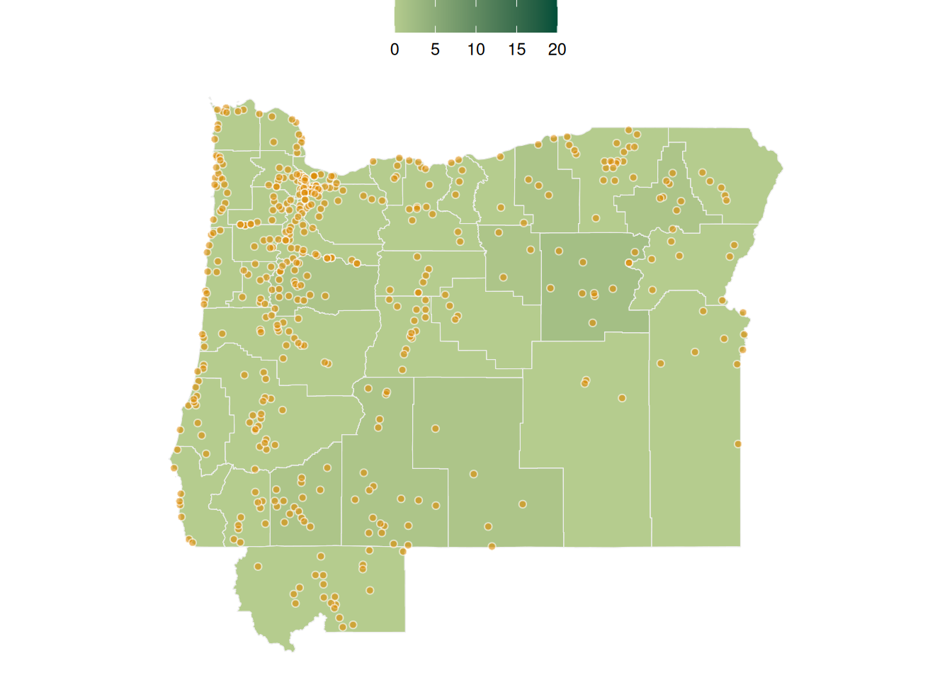
The number of cities and towns by county
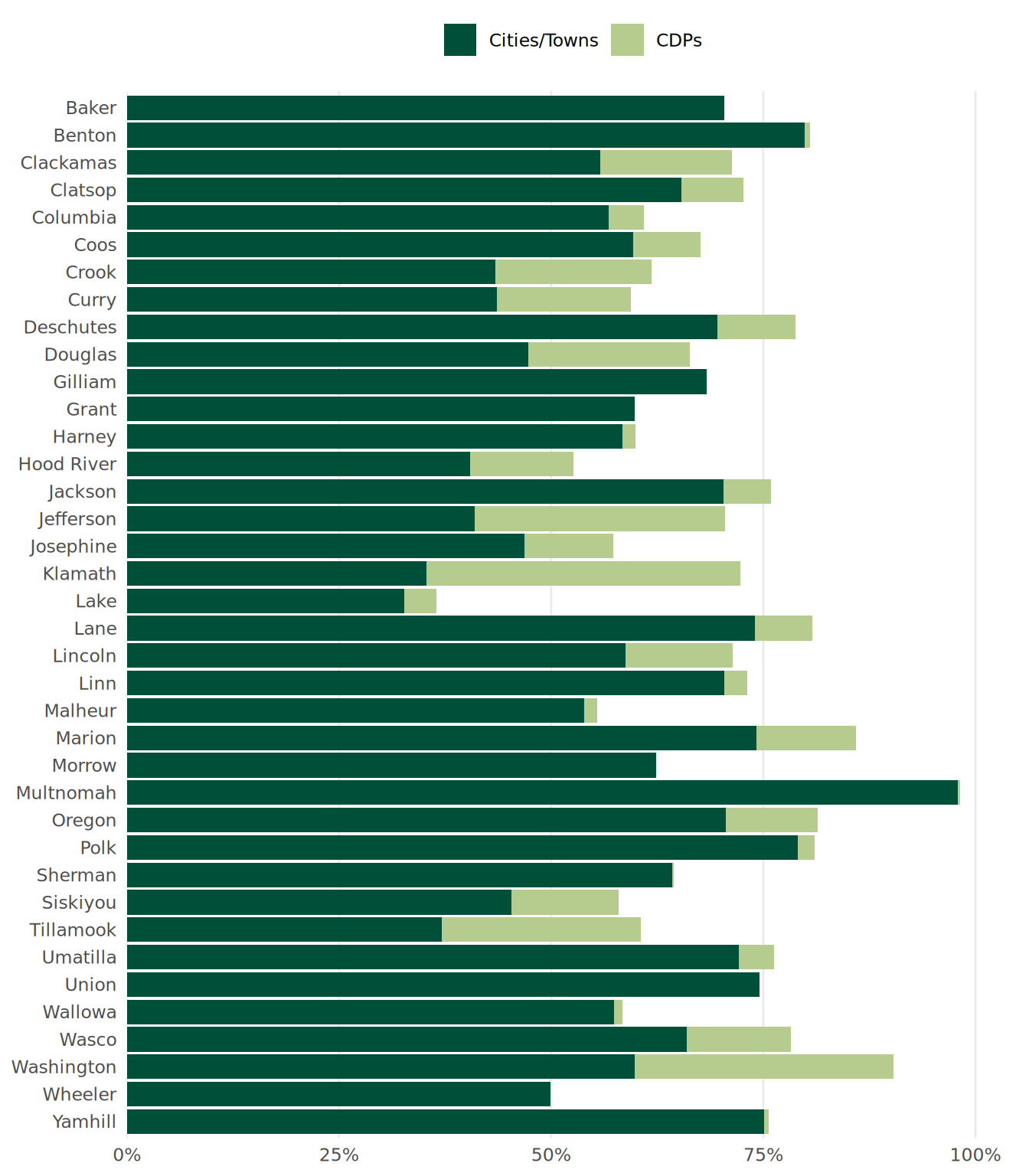
By county, what percent of people live in which cities and towns? What percent of people live in CDPs? What percent of people live outside of those three designations?
The spreadsheet Shannon sent doesn’t have data on the percent of people in individual cities/towns. So, here I’m just showing the the total percents.
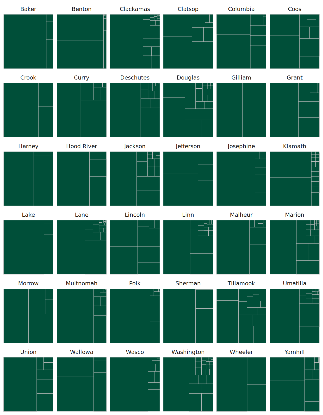
Places by Population Size
I can, however, get data on populations by place from the Census Bureau. I made a couple charts based on this data.
This is a treemap chart that shows the percentage of people in each county by place. What you can see is the breakdown across different places. For example, in Josephine, you can see how Grants Pass is over half of the total population. You don’t see the total population represented here, just the percent breakdown for each place.
Another way of showing this data is with circle packing. Here you can see the total size (by size of each circle) as well as the breakdown (again, if you look at Josephine, you see one large circle for Grants Pass).
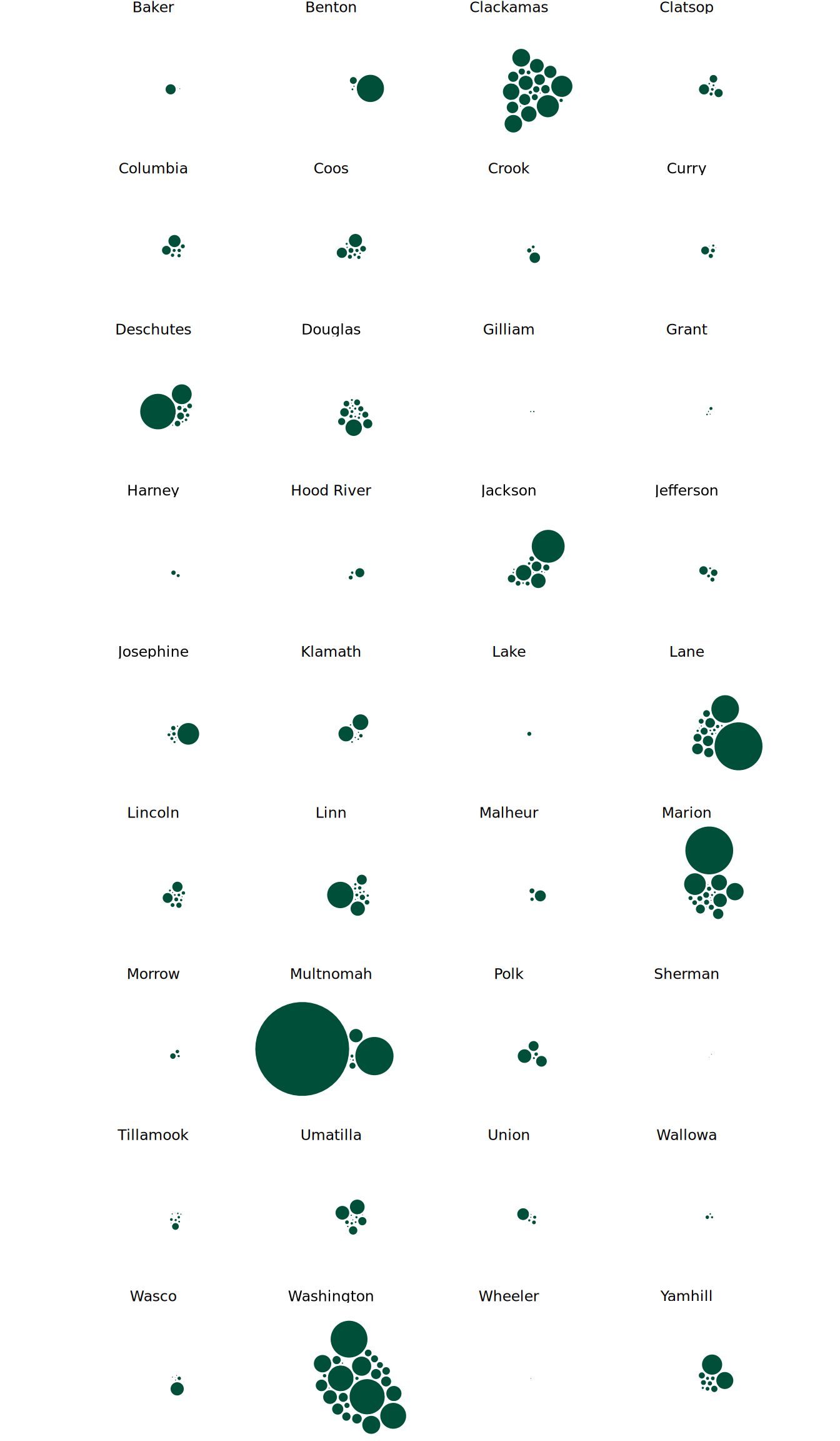
One thing to note on both the treemap and the circle packing is that some places are being counted multiple times because they are in multiple counties (e.g. Portland in Multnomah, Washington, and Clackamas). Not sure how you want to deal with this.
Maps
Shade by number of cities and towns in each county
TODO: Clarify if they mean actual cities and towns (i.e. drop CDPs)
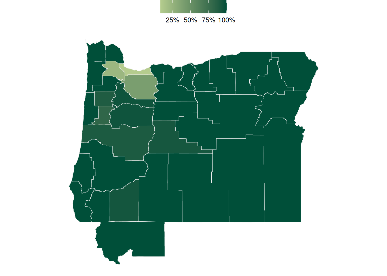
Shade by percent (?) of municipalities in a given county that are rural/urban
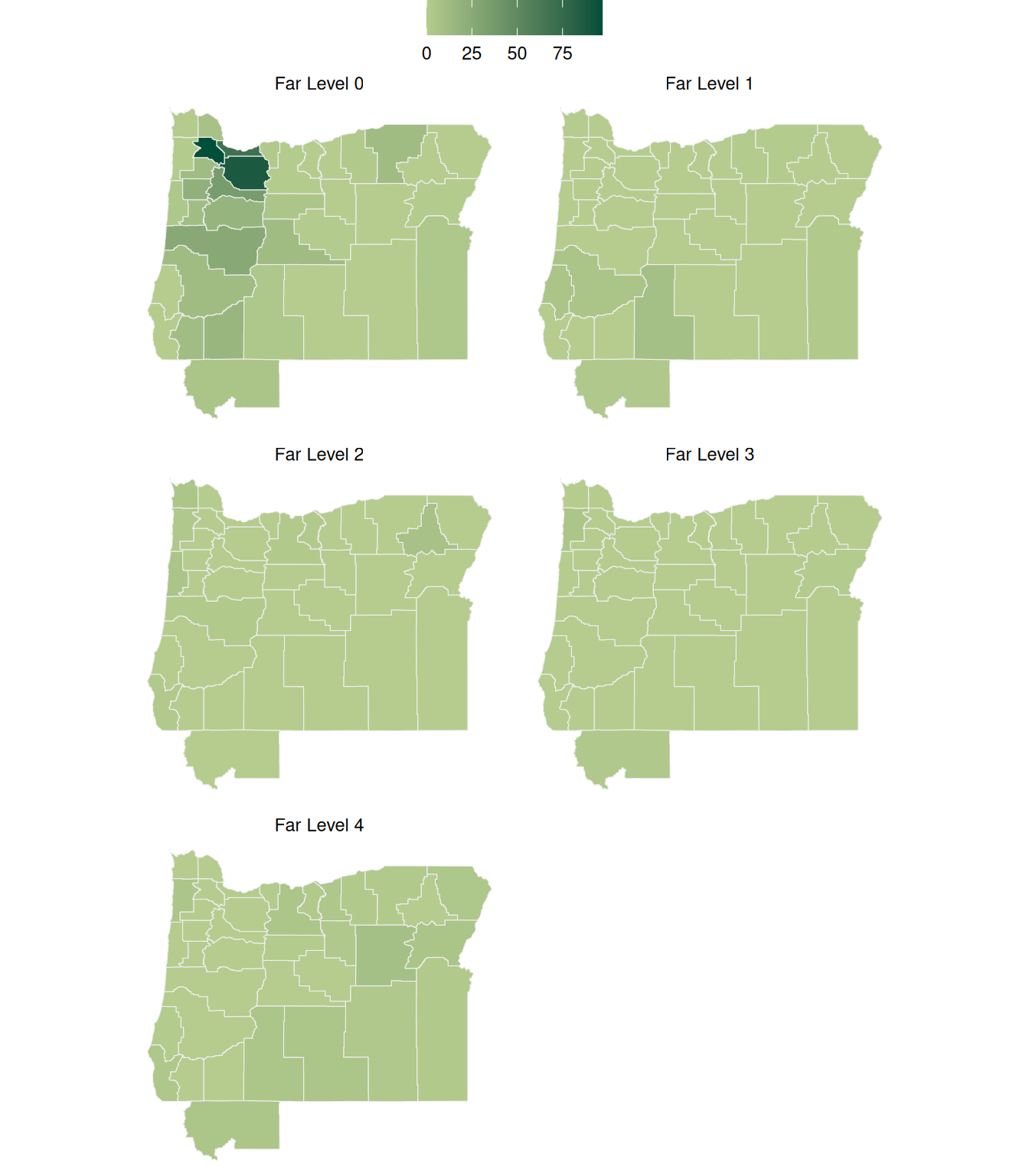
Shade by FAR level designation…. Maybe number of municipalities at each FAR level?